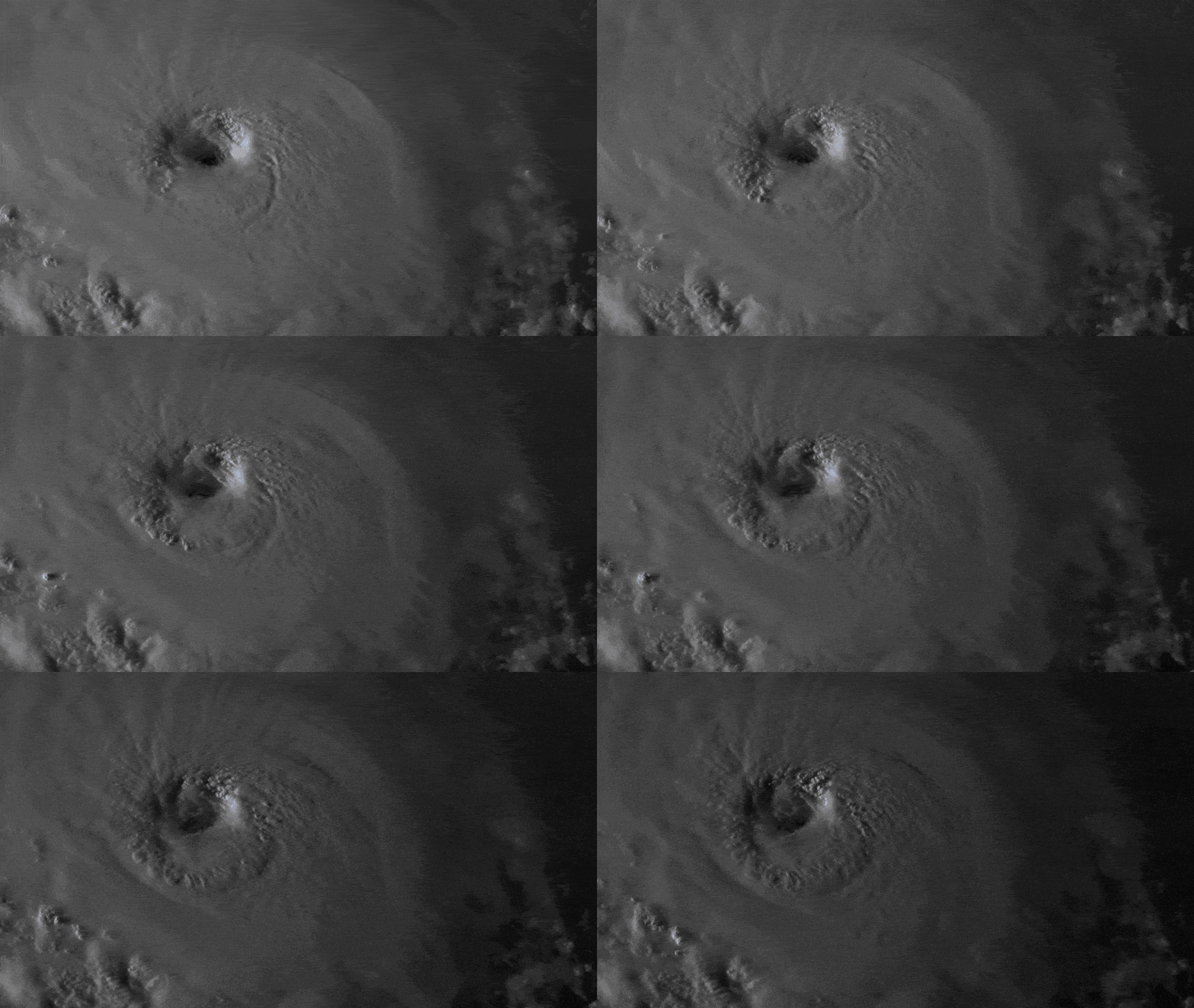
Hurricane Florence's Slow Speed Is Ominous
The “storm of a lifetime” is forecast to stall just offshore, making it even more dangerous.

There’s something particularly worrying about the forecast for Hurricane Florence—and it’s not only that the storm will likely make landfall later this week as a life-threatening major hurricane.
Over the next two days, the winds that guide the movement of storms across Earth’s surface—winds that meteorologists call “steering currents”—will push Florence over a patch of extremely warm ocean and shunt it toward the United States. It will feed on these waters, gaining strength, so much so that its sustained winds may top 155 miles an hour by Wednesday evening. Meanwhile, the eye of the storm will come within striking distance of the coast of the Carolinas.
And then, late on Thursday, these steering currents will “collapse,” according to the National Hurricane Center. The storm’s movement will slow to a crawl, and with enormous and lumbering intensity it will come to rest against the shore. After traveling more than 350 miles each day this week, the storm may move just 75 or 85 miles on Friday.
This is what worries meteorologists. A slow-moving hurricane is an especially dangerous hurricane. Once it makes landfall, Florence will not whisk inland, smearing a hurricane’s worth of rain across the country. Instead, it will dump its moisture in just a handful of states. Parts of the Carolinas and the mid-Atlantic could see between 15 and 25 inches of rain by the end of the weekend. Some areas could see 35 inches. This rain could fall far inland from the coast, flooding rivers and streams and augmenting the more “traditional” dangers of hurricanes: storm surge and high winds.
This stalling also makes the hurricane hard to forecast. In its late-night briefing, the National Hurricane Center warned of “substantial uncertainty” in the storm’s track after Friday. It also shifted the storm’s projected point of landfall south. Some individual models (which aren’t endorsed by the National Weather Service) suggest that Florence could stall off the coast of North Carolina on Friday evening, remaining just offshore well into Saturday.
All these effects together—the uncertain track, the astronomical rainfall, the life-threatening storm surge, and winds that will likely exceed 110 miles an hour—make for an exceptionally dangerous storm.
“This will likely be the storm of a lifetime for portions of the Carolina coast, and that’s saying a lot given the impacts we’ve seen from Hurricanes Diana, Hugo, Fran, Bonnie, Floyd, and Matthew,” warned a National Weather Service meteorologist in Wilmington, North Carolina, near where the storm is forecast to make landfall. “I can’t emphasize enough the potential for unbelievable damage from wind, storm surge, and inland flooding with this storm.”
All of this talk of a “stalled storm” may sound familiar. Last year, Hurricane Harvey stalled out as it approached Houston. It lingered over that city for more than two days, during which it both moved slowly and took a zigzagging track that kept it over the metro area. Ultimately, Harvey killed 88 people and displaced more than 30,000.
Neither Harvey nor Florence will be the last slow-moving cyclone to strike the United States. Stalled hurricanes appear to be getting more common, and human-caused climate change may be to blame.
According to a paper published earlier this year in the scientific journal Nature, hurricanes are now moving more slowly across the Earth than they once did. From 1949 to 2016, the speed of tropical cyclones worldwide over land decreased by 10 percent.
In the North Atlantic, where both Harvey and Florence originated, hurricanes have slowed some 20 percent in their track speed. (This study did not account for 2017’s slow storms, including Harvey.)
“Storms can get worse without getting more intense” if they’re slow moving, James Kossin, the author of that paper and an atmospheric research scientist at the National Oceanic and Atmospheric Administration, told me at the time.
“That’s just through very fundamental mathematics, because if you slow down how fast a storm is moving through a neighborhood, there’s probably more rain; storm surge would probably be greater; and while wind speeds won’t get any stronger, the amount of time that structures are hit by that wind would get longer,” he said.
The paper did not formally attribute this effect to human-caused climate change, but scientists have long hypothesized that tropical cyclones will move more slowly in a warmer world. That’s because a warmer world will have more stagnant, slow-moving air masses, which will stall out storms of all types around the world. And while tropical cyclones are very powerful systems, they are largely blown around the planet by the same global circulation that carries normal squalls. “Tropical cyclones are, for the most part, just carried passively along in the background wind,” Kossin told me.
Another study, published this year in the Journal of Climate, found that when computer models simulated 32 hurricanes in a warmed climate, those hurricanes were more likely both to be more intense and to stall out. And last year’s National Climate Assessment, a report produced by academic scientists, civilian agencies, and the military, similarly found that global warming will likely produce more frequent major hurricanes. The number of minor hurricanes may decrease.
Kossin warned that slower hurricanes could change how governments prepare for storms. “We get people out of harm’s way along the coast pretty well because historically, most mortality was associated with storm surge,” he said. “But we don’t typically evacuate people who are inland. And this slowing is going to impact inland flooding.”
According to the NWS, the Carolinas will face that inland flooding—and the “serious hazards” that come with it—this weekend, “regardless of where exactly the center moves.”